Walk :
|
Description |
GR11 is the
Spanish equivalent of the French GR10, running the length of the |
|
Duration |
about 24km;
about 6-8 hours Could be linked
to the Hendaye walk
to make a long circuit |
|
Suggested
Itinerary |
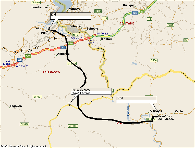
Start at Bera (Vera de Bidasoa) and follow GR11 heading generally
west to the San Anton reservoir, then generally north to |
|
Airport |
Biarritz then train to Hendaye or |
|
Accommodation at
start |
Plenty of hotels
in Hendaye and Irun. These towns are
close together, either side of the border.
They are linked by rail, a road bridge and the narrow gauge railway EuskoTren, which runs from outside Hendaye station (Hendaia) to Irun and continues
to San Sebastian (Donastia). |
|
Transport to
start |
The Irun to
Pamplona bus leaves Irun railway
station at 0800 (0900 on Sundays) and calls at Bera
half-an-hour later. Buy your ticket at
the Alsa kiosk in the station (fare in Feb 2006 was
1 euro). |
|
Route |
Leave Bera by a narrow lane on the right as you head south on
the village main street. This takes you over an old bridge over the Bidasoa; turn
right onto the road at the far side then very soon fork left up the hill on a
side road. This crosses the hill under which the main N-121A road
tunnels. Soon look out for GR11
fingerpost and take a right fork to join a track that climbs steadily through
the woods. Follow the track westwards
and watch out for occasional red-and-white waymarks. After 3-4 hours you will reach the road
which crosses the dam of the San Anton reservoir. At the far end
of the dam, turn right and follow the road north, leaving it to continue on a
track in the same direction where the road bends right. Follow this track as it contours and then zig-zags up to reach a road near Ursain. GR11 leaves the road to the right near
Pagogana and follows tracks to descend into |
|
Waymarking and
terrain |
Generally
sparsely waymarked before the reservoir; very well signed from there to the
end. Follow green-and-white local waymarks to leave
Bera and pick up yellow-and-white local waymarks before San Anton. The whole route is easy walking
on forest paths and tracks. |
|
Transport from
end |
You finish at |
|
Accommodation at
end |
as start |
|
|
Editorial Alpina 1:40,000 ‘Bidasoa Belate’ (part of Baztan Bidasoa 2-map pack) shows most of the route, but stops
about 5km short of Irun. However, the route shown on the map is not as
currently waymarked in the area of San Antongo Eskola and in the area of the zig-zags
up to Ursain, so do watch out for the signs in these places. The map also wrongly shows the route as
following the road north of Pagogana.
Watch for the well-marked route off to the right of the road and off
the top edge of the map. |
|
Views |
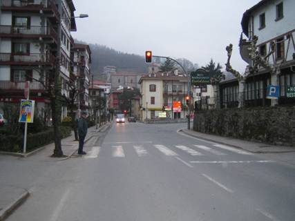
Bera main street looking north [photo:
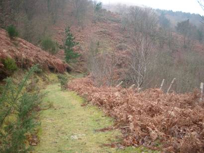
Near San Antongo Eskola
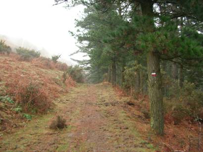
GR11 after leaving the road north of
Pagogana |
Walks Index
style='mso-tab-count:1'>
Comments are welcome – mail me at John@Jomidav.com