Walk : Hendaye route map
|
Description |
GR10 is the
long-distance path along the Pyrenees from the Bay of Biscay at Hendaye to
Banyuls on the Mediterranean. This is a short hike
at the western end of GR10 through the gentle low green hills of the Basque
country. It’s easy walking on good paths, reaching a maximum height of 317
metres. |
|
Duration |
about 20km;
about 5-6 hours Could be linked
to the Irun walk to make a long circuit |
|
Suggested
Itinerary |
Start at Bera
(Vera de Bidasoa) on the Spanish side, climb gently through beech and sweet
chestnut forests up to the border at Col d’Ibardin and follow GR10 down to
the coast. |
|
Airport |
Biarritz then train to Hendaye or Irun |
|
Accommodation at
start |
Plenty of hotels
in Hendaye and Irun. These towns are
close together, either side of the border.
They are linked by rail, a road bridge and the narrow gauge railway EuskoTren,
which runs from outside Hendaye station (Hendaia) to Irun and continues to
San Sebastian (Donastia). |
|
Transport to
start |
The Irun to
Pamplona bus leaves Irun railway
station at 0800 (0900 on Sundays) and calls at Bera half-an-hour later. Buy your ticket at the Alsa kiosk in the
station. |
|
Route |
Start in Bera at
the right-angle bend on the old Irun-Pamplona road (the modern road by-passes
the village). The road to Irun runs
west at this point and you take an unmarked lane heading north. Follow this lane as it zigzags and twists
up the hillside and keep heading northwards at any junctions. In about 30-40
minutes you meet a clearing and small settlement where six paths meet. The one you want is the one closest to
north and is marked with a spray-painted red arrow. This continues through forests to reach a
car park and hotels in about another 30 minutes. Here you pass
into France. This is signposted Col d’Ibardin, but the map shows this name at
the point where the road crosses the border, some distance east. Turn left on to GR10 and follow the red and
white waymarking as the route contours round Mandale and descends through the
hamlet of Biriatou to Hendaye and through the town to Hendaye Plage. |
|
Waymarking and
terrain |
No signposts or
waymarks on the Spanish side (except informal one mentioned above), but
excellent GR ‘balises’ in France. Easy walking on
tracks and paths. |
|
Transport from
end |
You finish at
the beach at Hendaye Plage, within easy reach of Hendaye station. |
|
Accommodation at
end |
as start |
|
|
IGN 1:25,000
sheet 1245OT has all the details. IGN 1:50,000
Pyrenees Carte Nr1 ‘Pays Basque Oest’ also shows the full route. Editorial Alpina
1:40,000 ‘Bidasoa Belate’ shows the Spanish section. This is sold as part of a 2-map pack named
‘Baztan Bidasoa’ The 1:25,000 map
has two places both named as Vera / Bera de Bidasoa; the place you want is
half way between. The Spanish map
names this spot Bera / Vera de Bidasoa. |
|
Comments This is an ideal
walk for a winters day. |
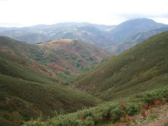
The hills of the
Basque country
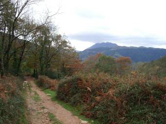
Les Trois
Couronnes from GR10
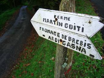
Sheep’s cheese
and red-and-white waymarking |
Walks Index
Comments are welcome – mail me at John@Jomidav.com