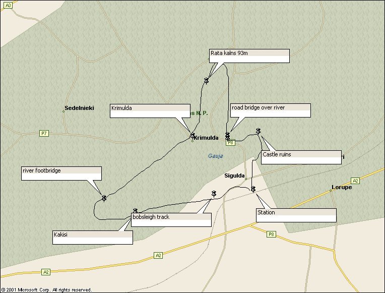
Walk : Sigulda route map
|
Description |
The Gauja
reaches the sea near Saulkrasti on the Baltic coast
walk. |
|
Duration |
3-6 hours (or
less if you use the cable car) |
|
Suggested
Itinerary |
Using the map
you can easily devise a circuit from the town; cross over the footbridge,
head upstream along the ridge and either drop down to return by the road
bridge and the castle ruins or double back to use the cable car. |
|
Airport |
|
|
Accommodation at
start |
Numerous hotels
in |
|
Transport to
start |
Train from |
|
Route |
From the
station, head west on the road on the north of the railway and keep going on
the track in the same direction, passing a bobsleigh track on your right. The
track passes through the hamlet of Kakisi and drops down to cross the river
on a suspension bridge. You can then
take either a forest track or a riverside path east and north to Krimulda. If
you choose the river path be ready for a very long flight of steps up to the
village. There is a shop and
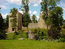
refreshments here and the cable car terminal is nearby. From the ruined
Krimulda castle, the path drops steeply down to a path junction by a lake and
you can then continue in the same general direction and climb up to the ridge
and along to the summit viewpoints of Rata kalns and Karla kalns. Various flights of steps lead you down to
the road, which you can cross to head south on a riverside path to the road
bridge. Rather than follow the road
back into Sigulda you can take a path on the left up the hill and through the
ruins of Sigulda castle and back into town. There are many longer
and shorter variations on this theme, including crossing the valley in either
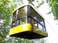
direction (or both) by cable car, but only in the summer months. |
|
Waymarking and
terrain |
Easy paths and
tracks but not many signposts. You will need the map. |
|
Transport from
end |
as start |
|
Accommodation at
end |
as start |
|
|
Jana Seta
1:100,000 map ‘Rigas Rajons’ (Riga Region) is all you need. This has
enlargement of Sigulda area on reverse. Jana Seta 1:15,000
map ‘Sigulda’ shows more detail and has photographs, history and tourist
information in English on the reverse. |
|
Comments |
Cable car and castle ruins (photos Sigulda Tourist Information office) |
Walks Index
Comments are welcome – mail me at John@Jomidav.com