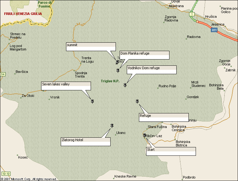
Walk : Triglav route map
|
Description |
Triglav
(pronounced ‘Triglaw’), 2864m, is the highest peak in the Julian Alps and is
Slovenia’s much-loved national symbol.
All Slovenians are supposed to climb it at least once and many do so
every year. This is a wonderful trip, but is strictly summer only. |
|
Duration |
The most
enjoyable ascent is a 3-day trip, staying overnight at mountain refuges, although
it is possible to take shorter routes. |
|
Suggested
Itinerary |
Start at Ribcev
Laz heading generally north-west, lunch at Vodnikov Dom refuge and sleep at
Dom Planika refuge just below the summit. Make an early morning ascent (best
chance of good weather on the summit) and back to the refuge for breakfast,
then head generally south-west by the Seven Lakes valley to spend the night
at the Koca Pri Triglavskih Jezerih refuge.
From here it’s only 2-3 hours descent to the bus terminus at the
Zlatorog hotel. |
|
Airport |
|
|
Accommodation at
start |
There is good
accommodation in the Bohinj valley; Hotel/Pension Stare is recommended and
Hotel Zlatorog and others can contacted through these links : http://www.globtour-bled.com/en/bohinj-hoteli.html http://www.bohinj.si/novice_en.html alternatively,
you can stay in Ljubljana (see airport page for
links) |
|
Transport to
start |
The Ljubljana to
Bohinj bus drops you at Ribcev Laz (10 minutes from the Zlatorog terminus). Times here |
|
Route |
Ribcev Laz,
Stara Fuzina (546m, shops), Planinska Koca Na Vojah (690m, refuge, food),
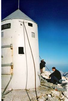
Vodinkov Dom (1817m, refuge, food), Dom Planika (2401m, refuge, beds, food),
Mali Triglav(2725m), Triglav summit (2864m), Triglavski Dom (2525m, refuge,
food), back to Dom Planika, Trzaska Koca Na Dolicu (2151m refuge, food),
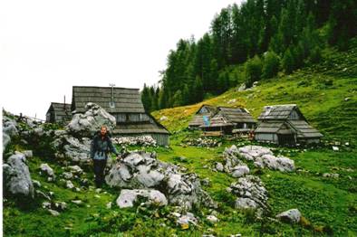
Seven Lakes valley (Dolina Triglavskih Jezer, Za Jezeram) to Koca Pri
Triglavskih Jezerih (1685m, refuge, beds, food). From here, head southeast to the summer
pastures at Visevnik (1625m) and descend southwest via Koca Pri Savici (653m,
food) to the Zlatorog hotel and the Bohinj valley. You don’t need
to pre-book beds at the refuges but you can do so at local tourist offices.
Alpine Association of Slovenia website. |
|
Waymarking and
terrain |
All routes are
waymarked. The routes are mostly
tracks or paths, but there are sections of fixed chain near the summit. |
|
Transport from
end |
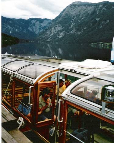
As start, also
the Bohinjsko lake boat
service links Ribcev Laz with Zlatorog. |
|
Accommodation at
end |
As start |
|
|
Planinska Zveza
Slovenije 1:50,000 Juliske Alpe (Julian Alps) and Planinska Zveza
Slovenije 1:25,000 Triglav. Both show the
waymarked tracks and refuges and both have details of the facilities and
opening dates of the refuges on the reverse. A useful
guidebook is Walking in the Julian Alps by Simon Brown (Cicerone Press) |
|
Comments |
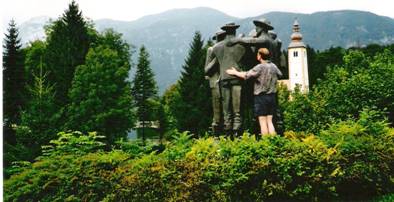
Statue of the early pioneers at Ribcev Laz
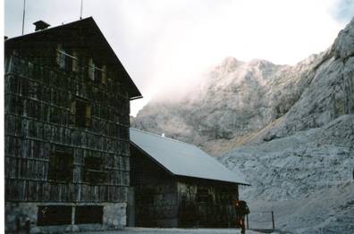
Dom Planika refuge and Triglav summit
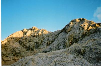
Early morning sun on the summit
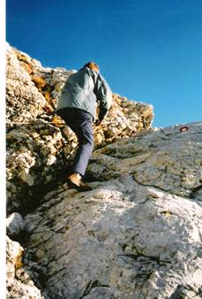
Ascending by fixed chain The summit shelter
Summer pasture at Visevnik (1625m)
The Bohinjsko lake boat links Ribcev Laz and
Zlatorog |
Walks Index
Comments are welcome – mail me at John@Jomidav.com