Walk : Tatra
Traverse route
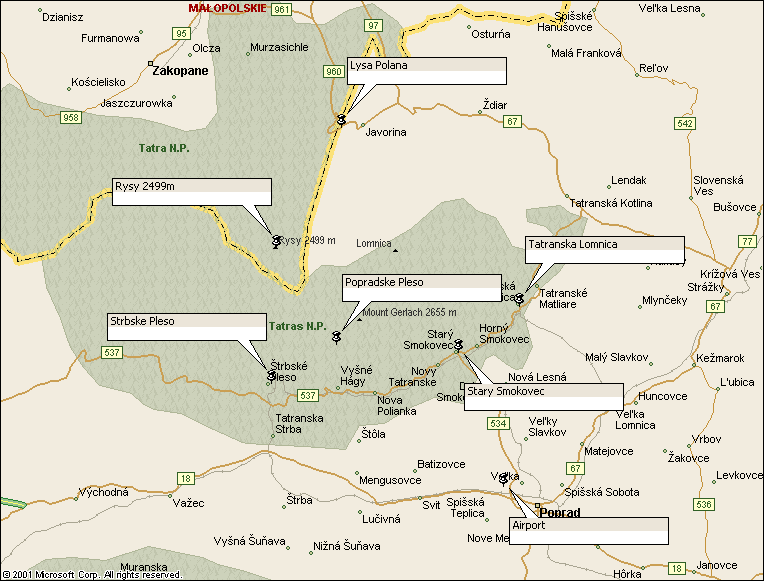
map
|
Description |
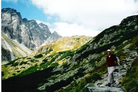
The High Tatras
straddle the Polish/Slovak border. This walk hugs the Slovak side of the
border and crosses the range at the Prielom saddle (2290m). This is a
summer-only route. |
|
Duration |
about 9 hours |
|
Suggested
Itinerary |
From Lysa
Polana, on the north side of the range, the waymarked path follows the Beila
Voda (White water) south along the border then climbs over the ridge to drop
down to the villages on the Slovak side. |
|
Airport |
|
|
Accommodation at
start |
Plenty of hotels
and hostels in the local villages such as: Stary Smokovec, Novy Smokovec,
Tatranska Lesna, Tatranska Lomnica.
See airport page for links. |
|
Transport to
start |
The morning bus
to Zakopane ( |
|
Route |
From the bus
stop, follow the blue marked path through the forest alongside the border
river. This climbs steeply up with some stretches of fixed chain, crosses the
col and continues down to Tatranska Lomnica. There are several opportunities
to take alternatives routes off to the right to reach other villages. |
|
Waymarking and
terrain |
Excellent waymarking,
colour-coded as shown on the maps. This is the TANAP national park and you
are not permitted to stray from the marked routes. |
|
Transport from
end |
as start |
|
Accommodation at
end |
as start |
|
|
VKU 1:50,000
sheet 113 ‘Vysoke Tatry’ (High Tatras) covers the whole area, including
Poprad and Zakopane (Poland) and shows all colour-coded walking routes. VKU 1:25,000
sheet 2 also called ‘Vysoke Tatry’ covers the mountain area in greater detail
but stops about 2k short of Lysa Polana. Both are GPS
compatible. |
|
Comments |
Tatra tracks |
Walks Index
Comments are welcome – mail me at John@Jomidav.com