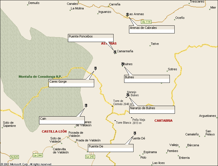
Walk : Picos de Europa : Picos Crossing route map
|
Description |
The Picos de Europe is a spectacular limestone range in
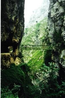
northern The Cares Gorge
itself is very dramatic and worthy of exploration. |
|
Duration |
One day to cross
the massif; another optional half-day or more to visit the Cares Gorge |
|
Suggested
Itinerary |
Start from the
top of the Fuente De cable car and head generally
north, skirting the conspicuous dome of Naranjo de Bulnes to reach Bulnes. From here descend to the road at Puente Poncebos. This is
the start of the Cares Gorge track, which could be followed south to Cain
(returning by the same route). |
|
Airport |
|
|
Accommodation at
start |
Plenty of
accommodation in Santander and Potes; also a Parador
hotel at Fuente De. |
|
Transport to
start |
Two or three Palomera
buses a day run from Times here;(select ‘Long Distance’ and From Fuente De (1078m), the cable car hoists you to El Cable
(1834m). |
|
Route |
From El Cable,
take the track north and then the branch to the northwest to pass the
Veronica refuge and reach the Vega de Urriello
refuge (1950m, food and beds, about 3-4 hours from start) at the base of the
magnificent Naranjo de Bulnes
(2519m high). Here pick up a track heading
generally northwards to the roadless hamlet of Bulnes (food) and descend northwest down the well-trodden
route to the valley at Puente Poncebos. |
|
Waymarking and
terrain |
Not very well
marked, but reasonably straightforward with a map. The route is rocky with
year-round snowfields. |
|
Transport from
end |
Occasional buses
(or 5km walk) from Puente Poncebos to Arenas de Cabrales; buses from there east to Panes or west to Cangis de Onis, both of which
have connections to |
|
Accommodation at
end |
Three choices at
Puenta Poncebos : Hotel Garganta del Cares (+34) 985846463;
Hotel Mirador de Cabrales
985846673 Hostal Poncebos 985846447.
Plenty more choices at Arenas |
|
|
Ediciones Adrados
publishes two useful maps. Picos de Europa at 1:80.000 shows the whole area and has photographs
and aerial drawing of the mountains on the reverse. The 1:25,000 Picos de Europa Macizos Central y Oriental (central and eastern massifs) shows
the route of the walk in detail, including the Cares Gorge. There is also a
sister sheet to this showing the western massif (Macizo
Occidental) at the same scale. |
|
Comments |
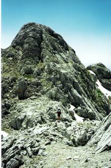
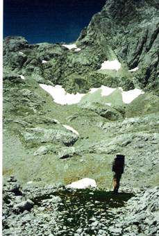
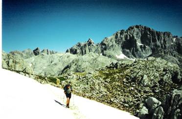
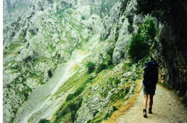
Crossing the Picos
(above) The Cares Gorge (below)
|
Walks Index
Comments are welcome – mail me at John@Jomidav.com