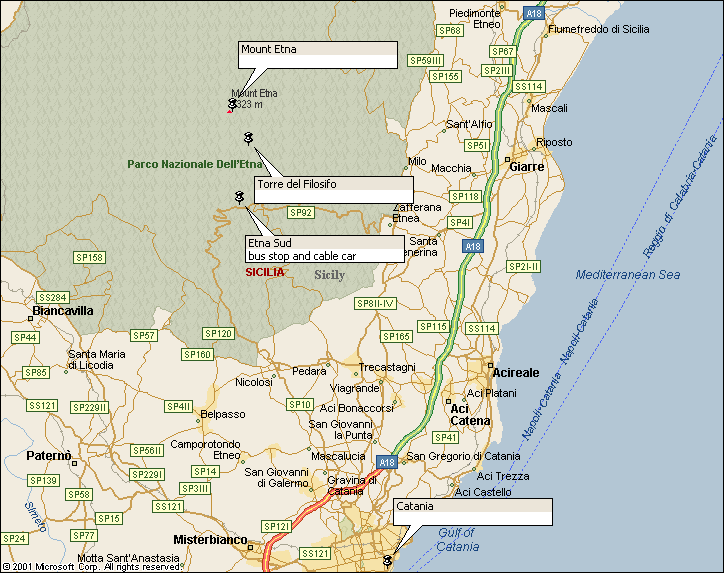
Walk : Mount
Etna route
map
|
Description |
|
|
Duration |
Variable to suit
the conditions and the time available |
|
Suggested
Itinerary |
Head up from Torre del Filosifo into the
high peaks and craters |
|
Airport |
|
|
Accommodation at
start |
Plenty of hotels
and lodgings at all price ranges in |
|
Transport to
start |
For From From the top
station of the cable car, a service of jeep mini-buses takes you to Torre del Filosfo (2919m). Return fare for
cable car and jeep is 42.50 euro.
Alternatively, walk up the jeep track all the way from the car park. |
|
Route |
Follow the track
|
|
Waymarking and
terrain |
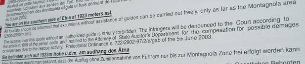
It’s all ash,
cinder and lava flows, unless covered with snow. Poles mark the track. As you are at a height of 3000 metres,
conditions can become very nasty very quickly, so be well prepared and turn
back if visibility becomes poor. Note
that a sign in the car park explicitly states that you are not permitted to
walk on the mountain without a guide, but this does not seem to be enforced,
other than as a mandatory 7 euro ‘guide fee’ included in the cable car fare.
|
|
Transport from
end |
Bus back to |
|
Accommodation at
end |
as start |
|
|
1:50,000 Parco
dell’ Etna published by Touring Club Italiano
covers the area of the national park. A
useful overview, but not good on detail. Better for the mountain itself is 1:25,000 Mt Etna ‘carta
escursionistica altomontana
/ touristic-high mountain map’ published by SELCA
of Florence in collaboration with Club Alpino Italiano. The 2005 edition shows the 2003 lava flows and
footpaths are clearly marked. Best overview
map is 1:60,000 Mt Etna ‘carta naturalistica
e turistica / naturalistic and touristic
map’ also published by SELCA / CAI. This covers the area as far as |
|
Comments |
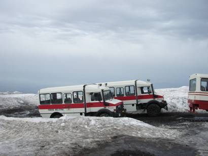
Jeep mini-buses
wait at the top cable car station
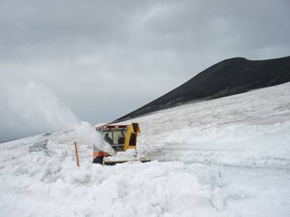
Keeping the jeep
track clear
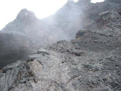
Steam pouring
from crater
Silvestri crater and view south |

Walks Index
Comments are welcome – mail me at John@Jomidav.com