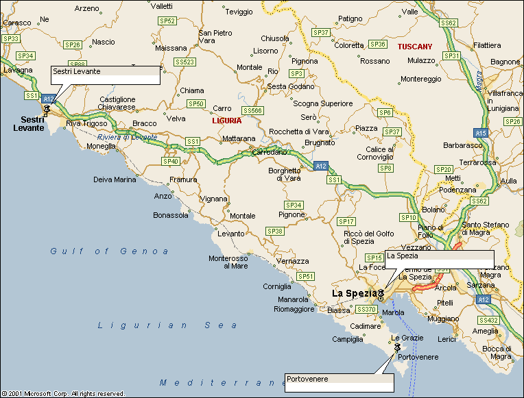
Walk : Cinque
Terre route
map
|
Description |
The Cinque Terre
(Five Lands) is stretch of coast with dramatic cliffs and picturesque
villages. There is no coast road and
the coastal path has a real feeling of remoteness in the stretches between
the villages. |
|
Duration |
One, two or
three days |
|
Suggested
Itinerary |
Start at
Portovenere and follow the long distance coastal path north. There are several villages or small towns
on the route, each with railway station, shops and accommodation so you can
easily devise a trip to suit the time available. |
|
Airport |
|
|
Accommodation at
start |
Several hotels in
Portovenere and elsewhere along the route.
Liguria Tourist Board and APT Cinque Terre
both have details. |
|
Transport to
start |
Trains from From La Spezia
station, descend the steps into Via Milano, turn left into Corso Cavour and
right into Viale Garibaldo where the half-hourly number 11 bus picks up for
Portovenere. Bus times and maps at ATC (select Oraria, |
|
Route |
The long
distance coastal path runs north from Portovenere to Riomaggiore, Manarola,
Corniglia, Vernazza, Monterosso, Levanto, Moneglia to Sestri Levine (and
beyond). The stretch from Portovenere
to Sestri Levine requires two overnight stops. All these places have full facilities and a
station. If selecting a shorter
section, the southern end is the more picturesque and the more interesting. |
|
Waymarking and
terrain |
Easy walking on
well-trodden paths with generally good waymarking. |
|
Transport from
end |
Trains from all
stations |
|
Accommodation at
end |
as start |
|
|
Edizioni Multigraphic 1:25,000
Cinque Terre shows the route as far as Levanto with paths marked in red. Kompass sheet 644 Cinque Terre at 1:50,000
shows the whole route and the waymarked paths and is very suitable for the
purpose. Neither map has a grid. |
|
Comments |
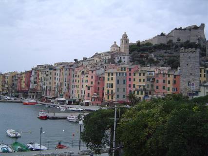
Portovenere
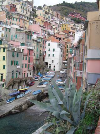
Riomaggiore
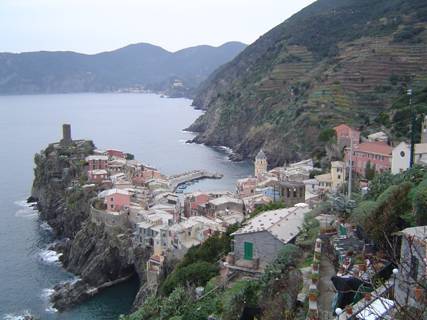
Vernazza |
Walks Index
Comments are welcome – mail me at John@Jomidav.com