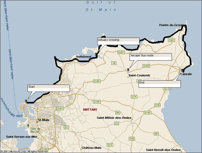
Walk : Cancale route map
|
Description |
Easy and
spectacular coastal walk along the beaches and cliffs of the |
|
Duration |
About 8–10 hours for the full route, depending on
stops, but there are opportunities to take short cuts or opt out and pick up
the St-Malo to Cancale bus. |
|
Suggested
Itinerary |
From St-Malo,
follow waymarked long-distance footpath GR34 in an easterly direction to
Cancale |
|
Airport |
|
|
Accommodation at
start |
|
|
Transport to
start |
Ferry service
between Dinard and St-Malo |
|
Route |
From the main
gate of the old walled city, follow the coast east along the promenade and
pick up the waymarking for GR34. The
path is mainly on the grassy cliff tops and fords an estuary after Rotheneuf
(with a high-water alternative). You
can omit some of the headlands and the Pointe du Grouin peninsula by checking
the map for short cuts (although the latter is the highlight of the walk). If you want to drop out, head a couple of
kilometres inland to pick up bus route along the D355 road through
St-Coulomb, parallel to the coast (times here). |
|
Waymarking and
terrain |
Well signed with
red-and-white GR marks. Easy walking. |
|
Transport from
end |
Two bus routes link
Cancale with St-Malo, one via St-Coulomb the other via St-Meloir providing an
irregular service of very roughly hourly frequency. Times for the St-Coulomb route are here.
The 2005 timetable for the St-Meloir route is here. |
|
Accommodation at
end |
Plenty of hotels
in Cancale |
|
|
IGN 1:25,000
1116ET shows the details of the route from the airport into Dinard and from
St-Malo to Cancale |
|
Comments |
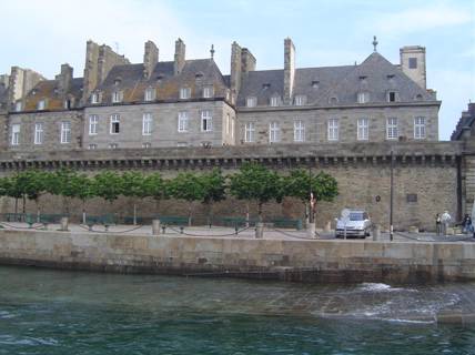
The walls of
St-Malo from the Dinard ferry
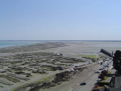
Cancale oyster
beds at low tide ..
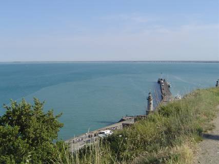
.. and at high
tide |
Walks Index
Comments are welcome – mail me at John@Jomidav.com